


Land Surveying Services
Professional land development, subdivision, and planning expertise.
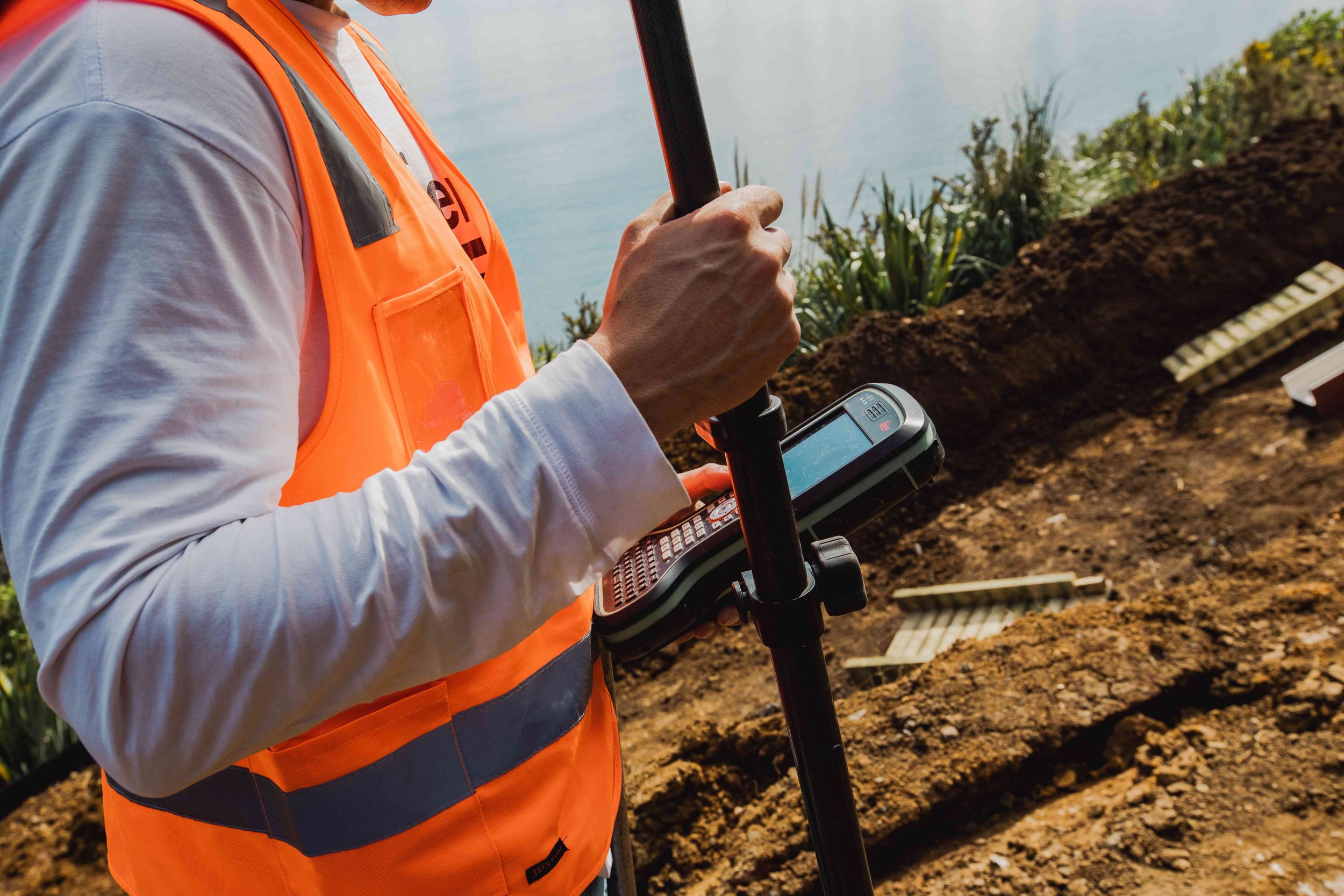
Our solutions-focussed Surveying team are strong believers in helping you determine feasibility in the early stages of your project. The team take a holistic approach to minimise the risks and costs of a project. From small scale residential through to multi-residential, commercial, rural and industrial sectors, our team are experienced in the full process of land development.
Our Surveyors are supported by an experienced admin team that work alongside you to help manage the information required to get your project off the ground. From the beginning, through the development phase, to the issue of new titles for subdivision. Our expert knowledge on navigating the subdivision process can ensure your project is delivered in a cost effective way.
Our Survey services include:
Land Transfer Subdivisions
Greenfield subdivision
Urban subdivisions
Rural subdivisions
Unit Title Surveys
Cross-lease updates and conversions to freehold
Right of way and easement surveys
Land Covanants and height restrictions
Project Management
Māori Land Surveys
Partitions & Hapu Partitions
Occupation Order plans
General Surveys
Topographical surveys and site plans
Boundary Lines/Property Boundary Definitions
Rentable area measurement (BOMA surveys)
Pointcloud data acquisition
Drone surveys & aerial images
3D Scanning
Construction Setout Surveys
Building setouts
Civil Works setout
Asbuilts survey
Monitoring surveys
Compliance Surveys
(Building Consent Certification)
Height to boundary surveys (Daylight/Overshadowing)
Minimum Floor level
Building Location surveys

Our Survey Team
Our team of surveyors has more than 25 years of experience across New Zealand. We always prioritise exceptional customer service. Our commitment is to manage each project with precision and care, meeting the unique needs of our clients.
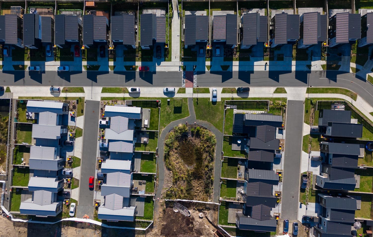
Our Surveying Projects


What our Clients say


FAQs
-
We work on all types of subdivisions, including rural, residential, commercial, industrial and unit title subdivisions.
-
Resource Consents are crucial for all subdivisions, boundary relocations, boundary adjustments, and cross lease plan updates. They are also necessary for various projects requiring a Land Use Consent for specific activities.
Starting the Resource Consent process at the beginning of your project is essential. We maintain strong relationships with local Councils and frequently discuss project feasibility to identify and resolve potential issues early on, ensuring a smooth process without unexpected surprises.
-
Boundary Lines/Property Definitions determine property boundaries, often requested by property owners before building additions, new construction, or fence installation. These surveys ensure structures are correctly placed, preventing future disputes.
Additionally, some sale and purchase agreements require boundary pegs to be in place before settlement. Trust our expert surveyors to provide accurate and reliable boundary surveys for all your property needs.
-
Topographical surveys are crucial before starting new building projects, alterations, or significant property changes. Our comprehensive surveys map out existing buildings, property features, services, and ground contours. This detailed information is invaluable for architects and builders, ensuring designs are perfectly tailored to the property's unique characteristics.
-
A BOMA (Building Owners and Managers Association) survey is a standardised method for calculating the floor area of commercial buildings. It ensures consistency in how space is measured, reported, and leased.
Will it disrupt my business operations?
Not at all. Our team works efficiently and discreetly to minimise any impact on your day-to-day activities. We coordinate closely with building managers to ensure a smooth process from start to finish.
-
You will typically need a BOMA survey when leasing, buying, or managing commercial property. It is essential for accurate lease agreements, property valuations, and space management. These surveys help avoid disputes by providing a clear and consistent measurement of usable and rentable areas.
About BCD Group
We are a team of passionate property professionals who get a kick out of shaping the built environment to meet the needs of our clients today and into the future. Over the last 14+ years we have solidified ourselves in the market as an industry leading, one-stop consultancy. Known for our award winning building designs for structural and fire engineering and land development projects.

Our Services


Civil
Engineering
Traffic & Transport
Engineering


Structural
Engineering
Draughting


Surveying
Environmental
Geotechnical
Engineering

Fire
Engineering
Our Locations
